

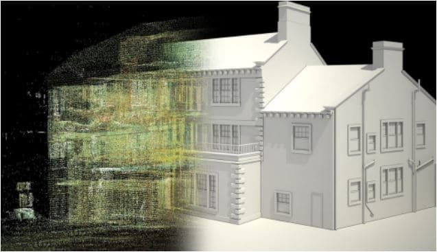
When projects begin with uncertain measurements, every decision downstream becomes slower, riskier and more expensive. Wolk addresses this bottleneck by turning existing buildings into accurate 3D building data that design and construction teams can trust from day one. Through professional 3D laser scanning, the team captures real geometry and delivers a coordinated point cloud, measured drawings and BIM-ready models that reflect true conditions. Architects, engineers, contractors and property professionals gain a shared foundation for renovation, transformation and documentation, reducing guesswork and unlocking clearer collaboration at every stage.
From scan to certainty across design and construction
Unlike manual surveys that sample only what is easy to reach, a high-quality dataset records millions of spatial points across walls, floors, ceilings, staircases and façades, including hidden corners and irregular geometries. This comprehensive capture produces a single, consistent source of truth that cuts measurement errors and repeat site visits. Explore how a point cloud becomes the common reference for teams, aligning assumptions before they become costly changes. With verified existing conditions, feasibility studies are clearer, detailing is sharper and coordination sessions move from debating dimensions to solving real design challenges.
The strength of reliable existing-building data is felt throughout the project lifecycle. Early clash checks become more meaningful because dimensions mirror the site, not a schematic intent. Complex elements like sloped surfaces and level differences are documented once and shared with all disciplines, preventing fragmented revisions. With point cloud technology as the baseline, contractors compare intent with reality, engineers refine calculations with confidence, and owners receive dependable documentation that supports valuation, maintenance and future adaptation. In short, certainty at the start creates momentum all the way to handover.
Why Wolk and NEN 2580 measurements raise the bar
Precision is not accidental; it is built into the workflow. Wolk deploys professional-grade 3D laser scanning, registering multiple scan positions and rigorously checking alignment to reflect real geometry. Using high-end equipment such as Leica Geosystems scanners ensures cleaner data and better imagery, which is crucial for historic properties, intricate stairwells and complex façades. The result is a coordinated point cloud that supports measured drawings, BIM models, renovation planning, structural analysis and construction coordination, providing a durable digital record long after site access becomes limited.
Equally important is how deliverables are tailored to intent. Whether the focus is architectural design, engineering verification, or property documentation, Wolk adapts survey area, accuracy and level of detail to the task, integrating NEN 2580 measurements when area reliability matters most. This approach serves architectural and engineering firms seeking dependable base models, construction companies aiming to reduce site risk, and property owners who need transparent, defensible building data. For projects in dense urban contexts such as Amsterdam, this responsiveness keeps teams aligned and timelines predictable.
When you begin with a precise point cloud, every subsequent drawing, model and decision stands on firmer ground. If your next renovation, coordination effort or asset documentation demands clarity, Wolk is ready to convert existing conditions into decision-ready information that moves your project forward with confidence.
